Drones and Photogrammetry
Your entire site, measured in hours.
We fly DJI Enterprise drones with RTK and tie every flight to GNSS ground control points. The result is a complete terrain model with millions of points and a quality report. With LiDAR sensors we can now measure the ground in places where traditional methods cannot.
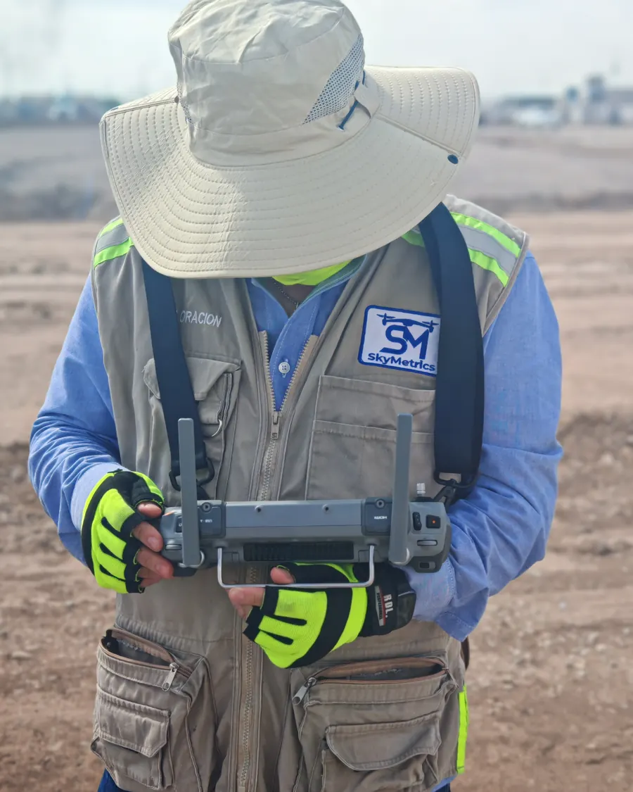 // FIELD · RTK FLIGHT
LiDAR: from point cloud to bare earth.
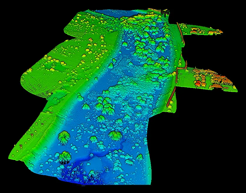
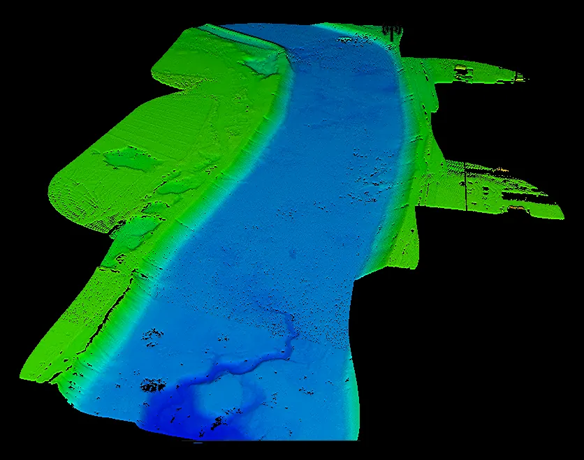
LiDAR laser pulses pass through dense vegetation and reach the ground. We classify every point (ground, vegetation, buildings): the ground points produce the DTM and all the points produce the DSM.
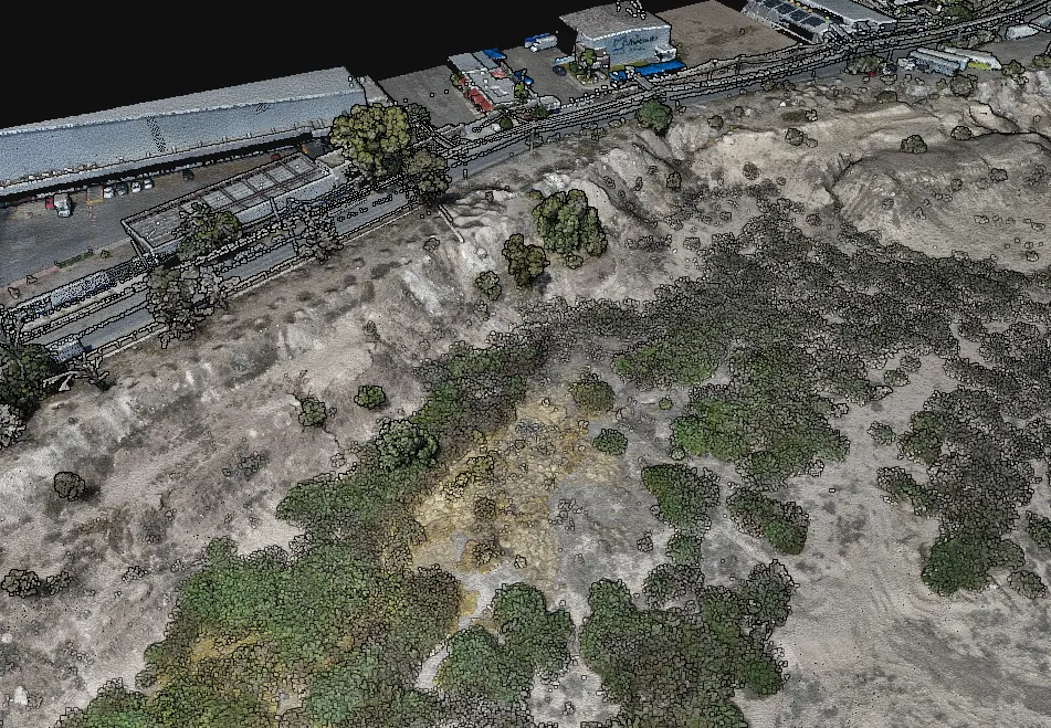
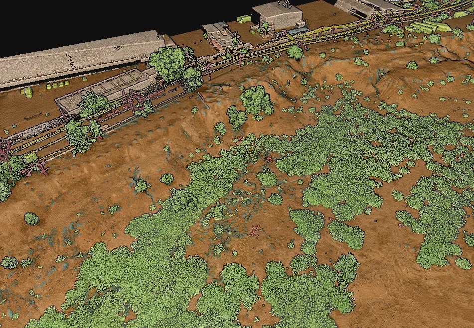
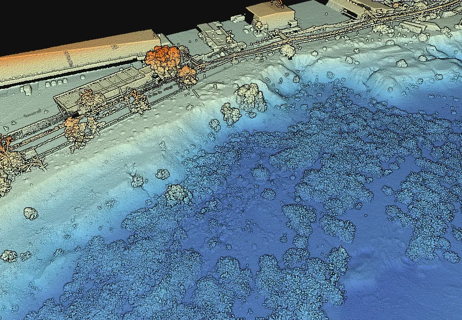
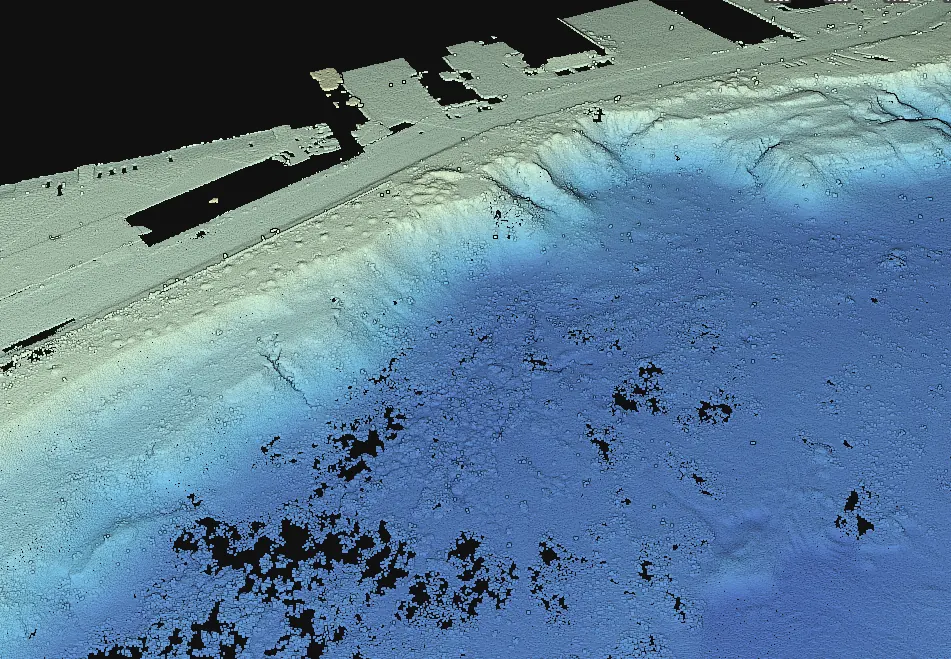 // LIDAR POINT CLOUD
Before and after removing vegetation
Slide to compare the full point cloud of a river channel with the terrain that remains.
When do you need it?
- Large or hard-to-reach sites.
- Volumes of pits, stockpiles and debris.
- Detailed design over large areas.
- Inspection of slopes, tailings dams and infrastructure.
- Vegetation-covered terrain (LiDAR).
- Visual documentation of a site.
What we deliver
How we work
Flight plan and GNSS ground control.
RTK flight.
Photogrammetric processing.
Quality control against check points and delivery.
// What sets us apart
Multi-software
Data is processed with specialized software such as DJI Terra, DJI Modify, Civil 3D and others.
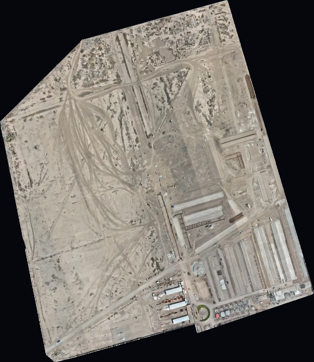 // ORTHOMOSAIC
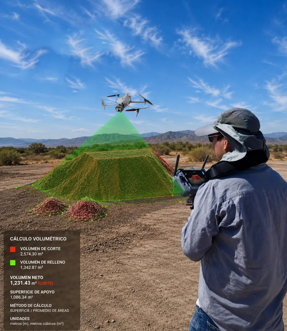 // VOLUMES
A SINGLE FLIGHT · 1,915 PHOTOS · GSD 1.9 CM · 100% RTK FIX · 447 MILLION POINTS
Frequently asked questions
How accurate is a drone survey?
With RTK and GNSS ground control points, accuracy is at the centimeter level. Every delivery includes a report against check points measured in the field, not just the software residuals.
What is the difference between a DSM and a DTM?
The DSM is the surface as seen from above, with vegetation, buildings and debris. The DTM is the bare ground, the one used for contour lines, design and cut-and-fill volumes.
When is LiDAR better than photogrammetry?
When the terrain is covered by vegetation. Photogrammetry only sees what appears in the photos, so under the brush there is no ground to measure; the laser does pass between the branches and reaches the terrain.
What formats do you deliver?
The ones you use: GeoTIFF and ECW for imagery, DWG/DXF for CAD, LAS/LAZ for point clouds, and web viewers to browse without installing anything.
// Contact
Have a project in mind?
Tell us what you need and we will prepare a proposal.